19 Million Tons Under Cameron Parish: Who Owns the Ground Beneath Project Minerva?
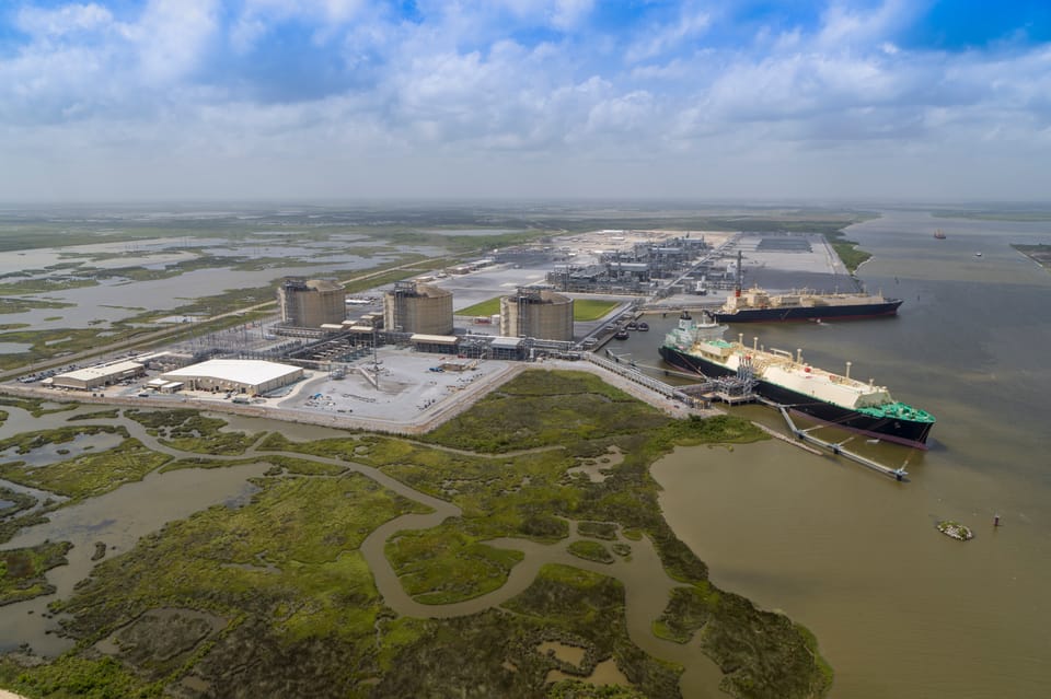
Gulf Coast Sequestration plans to inject roughly 19 million metric tons of carbon dioxide beneath Cameron Parish over 30 years. The wells sit on land tied to the Stream family, but the project’s regulatory footprint crosses numerous separately owned properties — raising a different question from whether the geology works: who controls the pore space underground?
HACKBERRY, La. — On the surface, Gulf Coast Sequestration’s proposed Project Minerva is concentrated around two wells in a single section of rural Cameron Parish.
Underground, the property lines become considerably more complicated.
Gulf Coast Sequestration, or GCS, is seeking final approval from the Louisiana Department of Conservation and Energy to construct and operate two Class VI carbon dioxide injection wells in Section 3, Township 12 South, Range 13 West.
The company’s current application anticipates injecting at least 19 million metric tons of carbon dioxide over approximately 30 years. The two wells would extend into the deep subsurface beneath Cameron Parish, with injection intervals generally around 9,000 to 10,000 feet below the surface.
The state held a public hearing on the draft permits July 23 at the Hackberry Community Center. C&E is now preparing a final decision on the applications.
But buried inside hundreds of pages of technical permit documents is a separate real-estate question.
Who has agreed to let GCS use the underground pore space — and what happens if the carbon dioxide plume or its pressure effects extend toward property owned by someone who has not?
The wells are on Stream-family-linked property
GCS does not own all of the land associated with Project Minerva.
Its application says the company has leased land from multiple Southwest Louisiana landowners, specifically identifying the Stream family among them. GCS says those agreements provide the property needed for its sequestration operation.
The two proposed injection wells themselves are located in Section 3.
C&E's property-owner records identify multiple parcels there associated with Stream Family Ltd. Partnership and related ownership interests, including Cameron Parish parcel numbers 0501133900 and 0501134500.
That establishes where the project begins.
It does not establish where every underground effect of the project ends.
A property line on the surface is not necessarily a boundary underground
Carbon sequestration does not work like placing something inside a buried tank.
The CO2 is injected into porous rock. It moves through tiny interconnected spaces within the formation while pressure from the injection also extends through the reservoir.
For permitting purposes, regulators therefore look at several different boundaries.
There is the physical injection site.
There is the modeled CO2 plume — the area underground where injected carbon dioxide is expected to migrate.
And there is the larger Area of Review, or AoR, which is intended to capture the area where the plume or pressure changes could create a pathway capable of endangering an underground source of drinking water.
Those are not necessarily the same footprint.
GCS's emergency-response plan currently identifies the delineated Minerva plume at approximately 2,965 acres.
Its Area of Review reaches across considerably more property.
C&E's June property-owner appendix identifies numerous separately owned parcels within the Minerva AoR, including individual owners, family trusts, LLCs, Stream-family entities and even Cameron Parish School Board property in Section 16.
Being listed inside the AoR does not mean GCS plans to inject CO2 beneath every one of those properties.
It also does not mean each owner has granted GCS storage rights.
It means the property falls within the project's regulatory review area.
That distinction matters.
Louisiana requires those neighboring owners to be identified
Louisiana law now specifically requires a Class VI applicant to make a reasonable search and good-faith effort to notify several categories of people within the surface or subsurface extent of the Area of Review.
That includes surface owners, mineral servitude owners, mineral lessees, oil and gas operators and certain well operators.
For surface owners, the law allows the applicant to rely on the parish assessor's ownership rolls.
That requirement helps explain why the Minerva application contains such a broad property-owner table even though GCS has not said it intends to use all of those properties for storage.
The AoR is fundamentally a safety and monitoring boundary.
The storage unit is a property-rights boundary.
Louisiana law defines that storage unit around the underground reservoir, seals and modeled carbon dioxide plume approved by regulators.
And that is where Louisiana's relatively new pore-space law becomes important.
You cannot simply take someone's pore space
In 2024, Louisiana substantially changed how carbon-storage developers can acquire subsurface storage rights.
The current law generally prohibits a storage operator from using eminent domain to simply take reservoir storage rights from a landowner.
Eminent domain can still be available for certain surface rights, pipelines and infrastructure associated with a storage facility, subject to statutory requirements. But the statute specifically says the ordinary expropriation authority does not extend to the reservoir storage rights themselves, with a narrow statutory exception related to Caldwell Parish.
Instead, Louisiana created a unitization system.
It resembles the concept used for oil and gas development: obtain agreements from a large enough share of the property, then seek a regulatory order combining the remaining interests into a common unit.
But the threshold for carbon storage is high.
Under the current version of Louisiana R.S. 30:1104.2, the commissioner cannot consider a compulsory storage-unit application unless at least 85% of the owners in interest within the proposed storage unit have consented in writing, calculated in proportion to the surface acreage represented.
After notice and a public hearing, the state can then unitize separately owned tracts and establish compensation for owners who did not voluntarily enter into storage agreements.
Those nonconsenting owners retain the right to seek judicial review of whether the storage unit serves a public and necessary purpose and whether the compensation is just.
The state website still says 75%. The statute says 85%.
There is an important discrepancy in the state's own public information.
C&E's current Class VI FAQ still tells landowners that a sequestration operator must acquire 75% of the acreage before the remainder can be unitized.
That was the law after the 2024 changes.
It is no longer the current statutory language.
Louisiana lawmakers subsequently raised the threshold, and the present version of R.S. 30:1104.2 requires 85%.
For a landowner trying to understand what rights can and cannot be compelled, that ten-percentage-point difference is significant.
But the actual lease price may never appear in the public record
There is another unusual aspect of pore-space transactions.
A property owner and sequestration company can enter into a detailed private geologic-storage agreement without recording the entire contract in the parish conveyance records.
Louisiana law allows the parties to record a Notice of Geologic Storage Agreement instead.
That notice must identify the parties and disclose the property and subsurface depths covered by the agreement, its effective date and term, renewal provisions and certain restrictions on drilling through the reservoir.
What the statute does not require that notice to disclose is the full financial arrangement.
That means public conveyance records can potentially tell a future buyer, title examiner or neighboring landowner that a tract is burdened by a carbon-storage agreement without revealing exactly how much the landowner was paid or every contractual term governing that agreement.
For Project Minerva, that distinction matters.
The permit application tells the public that GCS has leased property from the Stream family and other landowners.
The permit's property appendix tells the public who owns land inside the broader Area of Review.
Neither document, by itself, establishes the complete contractual map of who has granted GCS pore-space rights, for which exact storage depths, and under what compensation structure.
That requires a separate examination of the recorded Cameron Parish property instruments.
Then there is the plume
The property-rights issue becomes more important because the final underground footprint will not be determined solely by a map prepared before operations begin.
GCS is required to monitor what actually happens after injection starts.
Its May 2026 monitoring plan says the company will use operating data to determine whether the CO2 plume and pressure front are moving as predicted, update its geologic model and reevaluate the Area of Review.
The draft permit requires the AoR to be reevaluated at intervals of no more than five years — or sooner if operating or monitoring conditions warrant it.
One part of the monitoring plan illustrates the issue particularly well.
GCS intends to construct two groundwater-monitoring wells before CO2 injection begins.
But it will wait until after injection begins to determine the final location of a third monitoring well, known as MS USDW 3.
According to the plan, actual data will first be collected to determine the direction of the plume and pressure front. GCS and C&E will then select the third well's location inside the AoR, toward the projected movement south of the injection pad and before the project's first five-year reevaluation.
In other words, the permit itself recognizes that modeling comes first and actual underground behavior comes later.
That does not mean the plume is expected to escape its permitted storage area.
It means the regulatory system is designed around repeatedly checking whether reality matches the model.
Drinking water is much shallower — but it is the reason the AoR exists
The proposed injection zone is thousands of feet below the area's drinking-water formations.
C&E's draft permit places the deepest underground source of drinking water near the Minerva wells at approximately 1,100 to 1,200 feet below ground level. The proposed injection intervals are roughly 9,000 to 10,000 feet deep.
The vertical separation is substantial.
But Class VI regulations are built around preventing pathways that could allow CO2, displaced formation fluids or pressure effects to endanger those shallower aquifers.
GCS plans continuous well monitoring, groundwater sampling, seismic monitoring and repeated modeling during the project.
If monitoring indicates possible endangerment of an underground source of drinking water, the company's plan requires notification to C&E and EPA within 24 hours. Its emergency plan also includes shutdown and remediation procedures for scenarios involving CO2 or brine migration.
Louisiana law separately requires storage operators to perform groundwater-quality monitoring above the confining zone.
Does a neighboring landowner become liable if CO2 moves beneath the property?
Louisiana addressed that question directly.
Under R.S. 30:1109.1, a landowner does not assume liability for carbon dioxide simply by owning property or by entering into a contract allowing the property to be used for storage, injection or transportation.
The statute does preserve contractual obligations voluntarily assumed between the parties.
So the immediate concern for an adjacent property owner is not that simply finding CO2 beneath the property automatically makes the owner legally responsible for it.
The more relevant real-estate questions are different.
What rights have been granted?
Does the modeled storage unit reach the property?
Could an expanded plume require a future storage-unit adjustment?
Could additional access be needed for monitoring?
Could a storage agreement restrict future drilling or other subsurface uses?
And what does an existing carbon-storage agreement mean when the property is sold, mortgaged, inherited or subjected to mineral development decades later?
Those questions matter because Project Minerva is not a short-term use.
GCS anticipates approximately 30 years of injection, followed by a lengthy post-injection monitoring and closure period. Its application describes an overall project timeline approaching 89 years when development, operations and post-injection care are combined.
The permit decision will not answer every property question
C&E's immediate decision is whether Minerva's two proposed Class VI wells meet the technical and environmental requirements necessary for a permit.
That process has already examined well construction, geology, groundwater protection, emergency response, financial responsibility and long-term monitoring.
The public hearing in Hackberry is complete. The comment period is closed. The agency is now preparing its final determination.
But approving an injection permit and resolving every private-property interest beneath the project are not the same thing.
GCS has documented leases with local landowners.
Its proposed wells sit in Section 3 on property associated in the permit record with Stream-family interests.
Its modeled plume encompasses approximately 2,965 acres.
And its Area of Review reaches across a much broader collection of separately owned land.
The remaining property question is where those boundaries overlap.
That requires following the geologic storage agreements recorded in Cameron Parish, comparing their legal descriptions and storage depths against the modeled plume, and determining whether every tract expected to contain injected CO2 is already under contract.
If it is, Minerva may proceed entirely through negotiated storage rights.
If it is not, Louisiana's new 85% unitization law provides the pathway for what happens next.
For a project designed to remain beneath Cameron Parish for generations, the surface well pad may ultimately be the simplest part of the real-estate story.
Sources
- Louisiana Department of Conservation and Energy — Project Minerva Class VI public-hearing record.
- Gulf Coast Sequestration — May 2026 Project Minerva Class VI Application Narrative.
- Gulf Coast Sequestration — May 2026 Testing and Monitoring Plan.
- Gulf Coast Sequestration — Property Owners Within the Project Minerva Area of Review.
- Gulf Coast Sequestration — Emergency and Remedial Response Plan.
- Louisiana R.S. 30:1104.2 — Carbon-storage unitization.
- Louisiana R.S. 30:1112 — Notice of Geologic Storage Agreements.
- Louisiana R.S. 30:1108 — Eminent domain and reservoir-storage rights.
- Louisiana R.S. 30:1109.1 — Landowner liability.
- Louisiana R.S. 30:1115 — Class VI landowner notification requirements.
Follow the property records behind Southwest Louisiana's biggest projects. Subscribe to 337.NEWS for reporting on land, infrastructure, public records and development across the region.
About 337 News
337.NEWS is an independent Southwest Louisiana publication focused on real estate, public records, infrastructure, development, business, and the government decisions shaping the region.
Coverage often starts with the underlying documents: contracts, permits, property records, regulatory filings, public spending, land transactions, and other records that help explain what is actually happening beyond the headline.
337.NEWS covers Calcasieu, Cameron, Beauregard, Vernon, Allen, Jefferson Davis, and surrounding communities, with additional reporting on major Louisiana projects when they have implications for Southwest Louisiana.
The goal is simple: make complex local developments easier to understand and put the relevant records in front of readers.
About the Author
Dalton Barron covers real estate, infrastructure, development, public records and the underlying numbers shaping Southwest Louisiana for 337.NEWS.
Barron is also a licensed Louisiana real estate agent.
The views and reporting published by 337.NEWS are his own and do not represent the views or positions of NextHome Bayou Pines.
Dalton Barron
NextHome Bayou Pines
Jeremy Jones, Broker/Owner
C. 337.764.1754
O. 337.202.1018
Licensed by the LREC
Main Office: DeRidder, LA



Member discussion